Atlantic OceanCape Verde
17°00′N 24°00′W
Barlavento Islands
Ilhas de Barlavento
Part of Cape Verde Islands
Cabo Verde, officially known as Republic of Cabo Verde, is a group of arid Atlantic islands which are home to distinct communities of plants, birds, and reptiles.

Chart
Overview
Cabo Verde, officially known as Republic of Cabo Verde, is a group of arid Atlantic islands which are home to distinct communities of plants, birds, and reptiles.
From Wikipedia, CC BY-SA 4.0
Census, cataloged
- Major islands5
- Minor islands4
- Islets11
- Rocks & skerries8
Major islands
Santo Antão
- Area
- 784 km²
- High point
- 1,979 m
Santo Antão (Portuguese for "Saint Anthony") is the northwesternmost island of Cape Verde. At 785 km2 (303 sq mi), it is the largest of the Barlavento Islands group, and the second largest island of Cape Verde. The nearest island is São Vicente to the southeast, separated by the sea channel Canal de São Vicente.
Boa Vista
- Area
- 631 km²
- High point
- 390 m
Boa Vista (Portuguese for "good view"), sometimes spelled Boavista, is a desert-like island that belongs to the Cape Verde Islands. At 631 km2 (244 sq mi), it is the third largest island of the Cape Verde archipelago.
São Nicolau
- Area
- 345 km²
- High point
- 1,312 m
São Nicolau (Portuguese for Saint Nicholas) is one of the Barlavento (Windward) islands of Cape Verde. It is located between the islands of Santa Luzia and Sal. Its population is 12,424 (2015), with an area of 343 km2 (132 sq mi). The main towns are Ribeira Brava and Tarrafal de São Nicolau.
São Vicente
- Area
- 225 km²
- High point
- 750 m
São Vicente (Portuguese for "Saint Vincent"; Cape Verdean Creole: Sanvisenti) is one of the Barlavento Islands, the northern group within the Cape Verde archipelago in the Atlantic Ocean, off the West African coast.
Sal
- Area
- 220 km²
- High point
- 406 m
Sal (Portuguese for "salt") is an island in Cape Verde. Sal is a tourist destination with white sand beaches and over 350 days of sunshine a year. It is one of the three sandy eastern islands of the Cape Verde archipelago in the central Atlantic Ocean, 350 miles (560 km) off the west coast of Africa.


Minor islands

Santa Luzia
- Area
- 34.5 km²
- High point
- 397 m

Ilhéu Raso
- Area
- 5.7 km²
- High point
- 140 m
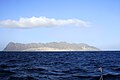
Ilhéu Branco
- Area
- 2.7 km²
- High point
- 370 m

Ilhéu de Sal Rei
- Area
- 0.89 km²
- High point
- 21 m
Islets
- Ilhéu Rabo de Junco8 m · 0.03 km²
- Ilhéu dos Pássaros3 m · 0.02 km²
- Unnamed island0.9 ha
- Ilhéu dos Pássaros (Boa Vista)1 m · 0.6 ha
- Ilhéu Derrubado0.5 ha
- Unnamed island6 m · 0.5 ha
- Ilhéu Holandês0.5 ha
- Ilhéu de Curral Velho and adjacent coast Important Bird Area0.4 ha
- Ilheu do Porto Ferreira2 m · 0.3 ha
- Unnamed island0.2 ha
- Ilhéu Zinho0.2 ha
Rocks & skerries
- Ilheu do Roque5 m · 0.02 km²
- Ilhéu de Baluarte3 m · 0.01 km²
- Unnamed island<0.1 ha
- Ilheú do Curral do Dadó<0.1 ha
- Unnamed island<0.1 ha
- Unnamed island<0.1 ha
- Unnamed island<0.1 ha
- Unnamed island<0.1 ha
Also in the area
Inside the group's outline but not confirmed as members by any source.
- Unnamed island0.03 km²
Figures
Comparative heights
- Santo Antão: 1,979 m
- São Nicolau: 1,312 m
- São Vicente: 750 m
- Sal: 406 m
- Santa Luzia: 397 m
- Boa Vista: 390 m
- Ilhéu Branco: 370 m
- Ilhéu Raso: 140 m
- Ilhéu de Sal Rei: 21 m
- Ilhéu Rabo de Junco: 8 m
- Ilheu do Roque: 5 m
- Ilhéu dos Pássaros: 3 m
- Ilhéu de Baluarte: 3 m
- Ilheu do Porto Ferreira: 2 m
To the same scale
Islands by area
| Santo Antão | 784 km² |
| Boa Vista | 631 km² |
| São Nicolau | 345 km² |
| São Vicente | 225 km² |
| Sal | 220 km² |
| Santa Luzia | 34.5 km² |
| Ilhéu Raso | 5.7 km² |
| Ilhéu Branco | 2.7 km² |
| Ilhéu de Sal Rei | 0.89 km² |
| Unnamed island | 0.03 km² |
| Ilhéu Rabo de Junco | 0.03 km² |
| Ilhéu dos Pássaros | 0.02 km² |
| Ilheu do Roque | 0.02 km² |
| Ilhéu de Baluarte | 0.01 km² |
| Unnamed island | 0.9 ha |
| Ilhéu dos Pássaros (Boa Vista) | 0.6 ha |
| Ilhéu Derrubado | 0.5 ha |
| Unnamed island | 0.5 ha |
| Ilhéu Holandês | 0.5 ha |
| Ilhéu de Curral Velho and adjacent coast Important Bird Area | 0.4 ha |
| Ilheu do Porto Ferreira | 0.3 ha |
| Unnamed island | 0.2 ha |
| Ilhéu Zinho | 0.2 ha |
| Unnamed island | <0.1 ha |
| Ilheú do Curral do Dadó | <0.1 ha |
| Unnamed island | <0.1 ha |
| Unnamed island | <0.1 ha |
| Unnamed island | <0.1 ha |
| Unnamed island | <0.1 ha |
Photographs

Blick auf die kapverdische Insel Sal von Süden. In der weiten Bucht in der linken unteren Bildhälfte liegt das Dorf Santa Maria.

Coastline Santo Antão

Punta de Ervantao

satellite image of the Cape Verde Islands

São Vicente Island, Cape Verde. The beach of Praia Grande and Monte Verde in the background Photo taken by Henryk Kotowski in November 2005.
Sources
Facts
Photographs
- Sal SantaMaria. Martikkk / CC BY-SA 3.0
- Coastline Santo Antao. Konstantin Krismer / CC BY 3.0
- Punta de Ervantao - panoramio. Fulvio Barudoni / CC BY 3.0
- Satellite image of Cape Verde in December 2002. NASA's Visible Earth / Public domain
- Calhau. Kotoviski (Henryk Kotowski) / CC BY-SA 3.0