Mediterranean SeaSpain
39°30′N 3°00′E
Balearic Islands
The Balearic Islands are an archipelago in the western Mediterranean Sea, off the eastern coast of the Iberian Peninsula, constituting an autonomous community and province of Spain, with Palma as their capital and largest city. 31 sq mi), the smallest.

Chart
Overview
The Balearic Islands are an archipelago in the western Mediterranean Sea, off the eastern coast of the Iberian Peninsula, constituting an autonomous community and province of Spain, with Palma as their capital and largest city. With a population of 1,249,844, they are the 6th least populous autonomous community of Spain, and with an area of 4,991.70 square kilometres (1,927.31 sq mi), the smallest. Historically part of the Kingdom of Majorca, the archipelago was established as a Spanish province and historic region in the 19th century and achieved self-government under its Statute of Autonomy in 1983. In the 2007 statute reform, the autonomous community of the Balearic Islands was defined as a "nationality" of Spain. The co-official languages are Catalan and Spanish. The archipelago is divided into two main groups: the western Pityusic Islands (comprising Ibiza, Formentera, and smaller surrounding islets) and the eastern Gymnesian Islands (principally Mallorca and Menorca). Notable minor islands include Cabrera, Dragonera, and S'Espalmador. The Balearic Islands form the second most populous and second-largest archipelago in Spain, after the Canary Islands. The region experiences a Mediterranean climate, and the four principal islands are major international tourist destinations. Ibiza has developed a prominent electronic music and nightlife industry, attracting internationally touring DJs to its nightclubs.
From Wikipedia, CC BY-SA 4.0
Census, cataloged
- Major islands3
- Minor islands18
- Islets78
- Rocks & skerries121
Major islands
Mallorca
- Area
- 3,622 km²
- High point
- 1,436 m
Mallorca, also spelled Majorca in English, is the largest of Spain's Balearic Islands, and the seventh largest island in the Mediterranean Sea.
Menorca
- Area
- 693 km²
- High point
- 362 m
Menorca or Minorca (from Latin: Insula Minor, lit. 'smaller island', later Minorica) is one of the Balearic Islands located in the Mediterranean Sea belonging to Spain. Its name derives from its size, contrasting it with nearby Mallorca (Majorca).
Ibiza
- Area
- 569 km²
- High point
- 486 m
Ibiza ( (US) (UK); Spanish: [iˈβiθa]; Catalan: Eivissa [əjˈvisə]; see below), or Iviza, is a Spanish island in the Mediterranean Sea off the eastern coast of the Iberian Peninsula. It is 150 kilometres (93 miles) from the city of Valencia.


Minor islands
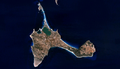
Formentera
- Area
- 80.7 km²
- High point
- 202 m

Dragonera
- Area
- 2.7 km²
- High point
- 312 m

S'Espalmador
- Area
- 1.5 km²
- High point
- 57 m

Illa des Conills
- Area
- 1.4 km²
- High point
- 106 m

Illa Conillera
- Area
- 1.1 km²
- High point
- 64 m

Es Vedrà
- Area
- 0.62 km²
- High point
- 382 m

Illa de Tagomago
- Area
- 0.6 km²
- High point
- 115 m

Colom Island
- Area
- 0.59 km²
- High point
- 41 m
s'Espardell
- Area
- 0.49 km²
- High point
- 28 m

Illa de l'Aire
- Area
- 0.31 km²
- High point
- 15 m
Illa del Llatzeret
- Area
- 0.3 km²
- High point
- 26 m

Illa de s'Espartar
- Area
- 0.19 km²
- High point
- 67 m

Illa des Bosc
- Area
- 0.17 km²
- High point
- 69 m
es Vedranell
- Area
- 0.17 km²
- High point
- 123 m
Illa de Formentor
- Area
- 0.12 km²
- High point
- 38 m

Na Redona
- Area
- 0.1 km²
- High point
- 55 m
Unnamed island
- Area
- —
size unknown
Unnamed island
- Area
- —
size unknown
Rocks & skerries
On the chart above, at its closest zooms.
Listing 21 of 220; the rest are on the chart.
Figures
Comparative heights
- Mallorca: 1,436 m
- Ibiza: 486 m
- Es Vedrà: 382 m
- Menorca: 362 m
- Dragonera: 312 m
- Formentera: 202 m
- es Vedranell: 123 m
- Illa de Tagomago: 115 m
- Illa des Conills: 106 m
- Illa des Bosc: 69 m
- Illa de s'Espartar: 67 m
- Illa Conillera: 64 m
- S'Espalmador: 57 m
- Na Redona: 55 m
To the same scale
Islands by area
| Mallorca | 3,622 km² |
| Menorca | 693 km² |
| Ibiza | 569 km² |
| Formentera | 80.7 km² |
| Dragonera | 2.7 km² |
| S'Espalmador | 1.5 km² |
| Illa des Conills | 1.4 km² |
| Illa Conillera | 1.1 km² |
| Es Vedrà | 0.62 km² |
| Illa de Tagomago | 0.6 km² |
| Colom Island | 0.59 km² |
| s'Espardell | 0.49 km² |
| Illa de l'Aire | 0.31 km² |
| Illa del Llatzeret | 0.3 km² |
| Illa de s'Espartar | 0.19 km² |
| Illa des Bosc | 0.17 km² |
| es Vedranell | 0.17 km² |
| Illa de Formentor | 0.12 km² |
| Na Redona | 0.1 km² |
Groups within
Photographs

sea view, Ibiza Spain


casa rural

Sources
Facts
Photographs
- Ibiza rock volcano (747230830). athinaf / CC BY 2.0
- Imagen satelital de Mallorca (Islas Baleares, España). Pierre Markuse from Hamm, Germany / CC BY 2.0
- Casa rural (36867131773). rey perezoso / CC BY-SA 2.0
- LA CALLE Y SU NOCHE...SOMBRAS Y LUZ. (8026962320). LIMA58 / CC BY 2.0
- Balearic Islands Wikivoyage banner. Adam Jones from Kelowna, BC, Canada / CC BY-SA 2.0