Bay of BiscayFrance
46°04′N 1°18′W
archipel charentais

Chart
Major islands
Oléron
- Area
- 174 km²
- High point
- 37 m
The Isle of Oléron or Oléron Island (French: île d'Oléron [il dɔleʁɔ̃], or simply Oléron [ɔleʁɔ̃]; Poitevin-Saintongese: ile d'Olerun or ilâte d'Olerun; Latin: Uliaros insula [uliˈaːros ˈinsula]) is an island off the Atlantic coast of France (due west of Rochefort), on the southern side of the Pertuis d'Antioche strait.
Île de Ré
- Area
- 84.7 km²
- High point
- 19 m
Île de Ré (French pronunciation: [il də ʁe]; variously spelled Rhé or Rhéa; Poitevin: ile de Rét; English: Isle of Ré, RAY) is an island off the Atlantic coast of France near La Rochelle, Charente-Maritime, on the northern side of the Pertuis d'Antioche strait.


Minor islands

Isle of Aix
- Area
- 1.4 km²
- High point
- 20 m
Île Madame
- Area
- 0.79 km²
- High point
- 14 m
Islets
- île de Nôle3 m · 0.03 km²
- Unnamed island1 m · 0.01 km²
- Fort Louvois1 m · 0.2 ha
- Fort Boyard1 m · 0.2 ha
Rocks & skerries
- Unnamed island<0.1 ha
- Puits des Insurgés<0.1 ha
Figures
Comparative heights
- Oléron: 37 m
- Isle of Aix: 20 m
- Île de Ré: 19 m
- Île Madame: 14 m
- île de Nôle: 3 m
- Fort Louvois: 1 m
- Fort Boyard: 1 m
To the same scale
Islands by area
| Oléron | 174 km² |
| Île de Ré | 84.7 km² |
| Isle of Aix | 1.4 km² |
| Île Madame | 0.79 km² |
| île de Nôle | 0.03 km² |
| Unnamed island | 0.01 km² |
| Fort Louvois | 0.2 ha |
| Fort Boyard | 0.2 ha |
| Unnamed island | <0.1 ha |
| Puits des Insurgés | <0.1 ha |
Photographs

LE GRAND VILLAGE PLAGE OLERON ISLAND

Île d'Oleron. Satellite view.

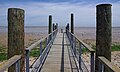
The way to the beach, Sainte-Marie-de-Ré, Ré island, Charente-Maritime, France.
Sources
Facts
- Geometry, areas and high points: OpenStreetMap contributors (ODbL), Copernicus GLO-30, via Talus.
- Wikidata
Photographs
- LE GRAND VILLAGE PLAGE OLERON ISLAND (15319810813). Eric Salard / CC BY-SA 2.0
- Île d'Oleron. NASA / Public domain
- Accès plage, Sainte-Marie, Ré island, august 2015. Jebulon / CC0